Triangulation
Photogrammetric control extension, or bridging, can yield satisfactory accuracy for computer generated horizontal and vertical photo control, and at a substantial savings over field work. There are two broad categories, analytical and analogical. Analogical involves a manual method using the stereoplotter, however this procedure is practically never used now. The analytical method is the preferred method using a monocomparator or a stereocomparator to measure photocoordinates of corresponding points on a stereopair of diapositives. Fully analytical triangulation corrects for film shrinkage or expansion, compensates for radial lens distortions, corrects for atmospheric refraction, corrects for earth curvature, and reduces the measured coordinates from fiducial axis systems to an axis system with origin at the principal point. This method is referred to as the polynomial method of strip and block adjustment. The most accurate method is called the simultaneous bundle block adjustment. In this procedure all equations for an entire block of photographs are formed and solved simultaneously. By solving both control and pass point equations simultaneously, a numerical relative and absolute orientation of all stereomodels is achieved. These equations are then solved by the least squares adjustment. The bundle technique is more rigorous than the polynomial method.
An area to be mapped requires known coordinates and vertical elevations of points on the ground. By relatively adjusting all the photos together, we can then position the entire job over the control points. The number of control points can be reduced substantially by using triangulation. The computerized bundle adjustment makes an absolute orientation of all models for the best fit to the reduced number of control points.
Close Range Photogrammetry
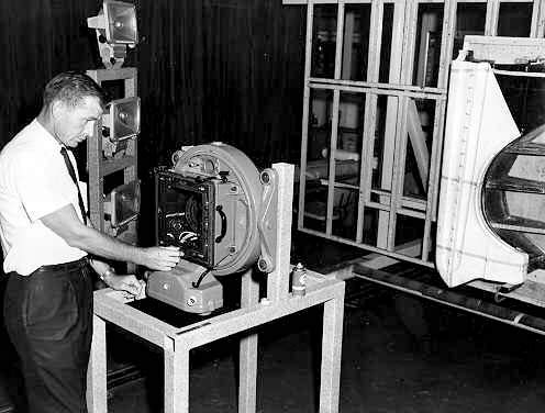
Wild RC-8 aerial camera mounted to photograph an auto fender for close range digitizing.
Photo by W. Mayo
Close Range, or terrestrial photogrammetry refers to photography exposed on the surface of the earth as opposed to "aerial photography". There is a long list of uses for this procedure, such as traffic accidents, dentistry, criminology, anthropology, architecture, medical X ray, conservation of historical monuments, highway engineering, bridge and tunnel construction, and ship and aircraft construction to name only a few. There are many different photographic techniques in obtaining negatives for close range usage. Two cameras mounted side by side will of course produce a stereopair of negatives. One camera exposed in two locations can produce the same results, or one stationary camera photographing an object mounted on an easel which is moved to two positions. The stereopair can be placed in a stereoplotter and using a technique similar to that required in producing aerial maps can produce whatever results are needed, such as spot elevations, cross sections, or planimetric detail.
Two examples of the use of close range are: traffic accidents and shipbuilding. It is impossible to have a flyover on every accident, so negatives produced on the ground can provide the capability of obtaining accurate measurements. This cannot be done with regular photography. In shipbuilding in some instances it is important to build the ship in parts and in different places. Using close range procedures coordinates can be created which will guarantee a proper fit when units are joined. Coordinates can be generated of all steam pipes and various equipment before installation to make sure that piece of equipment will fit when installed.
Aircraft
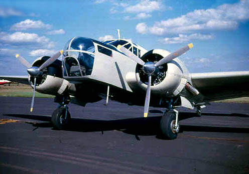
This AT-11 was one of the best in it's day.
Photo by W. Mayo
Types of aircraft used for aerial photography is a very interesting subject. We have already covered the RB-29 or F-13. There is no end to the list of desirable aircraft. The AT-11 served for years, but could not accept the new cameras in the nose section. Cessna aircraft are excellent, such as the 180, 185, and the turbo-charged 206. Learjet is great if money is no object.
Piper aircraft are good, with the Geronimo leading as the best mapping plane. To take an aircraft and cut a 24 inch hole in the bottom sometimes requires rerouting cables which is a costly job. So a Piper, Cessna, Lear, it just depends on ones personal preference. Also the type of work will determine the plane: altitude, size of project , number of cameras, etc. All these things must be considered before choosing a Cessna 320, or a Geronimo.
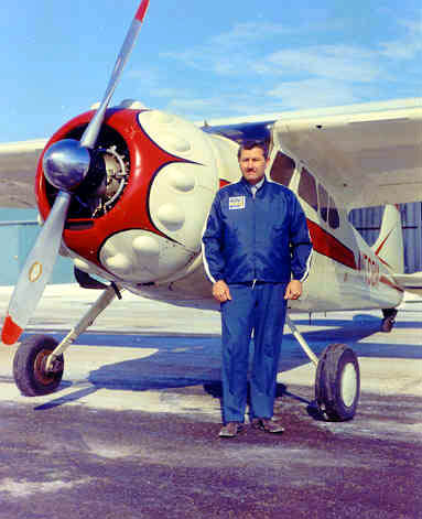
Wayland Mayo and Cessna 195 mapping airplane.
Photo ctsy W. Mayo
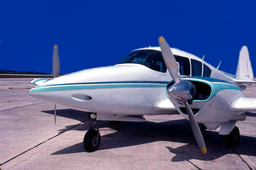
This highly modified Geronimo is a first class STOL mapping aircraft.
Photo by W. Mayo
Three Outstanding Aerial Photos
Mt. Cotopaxi in Ecuador taken from 20,000 ft.
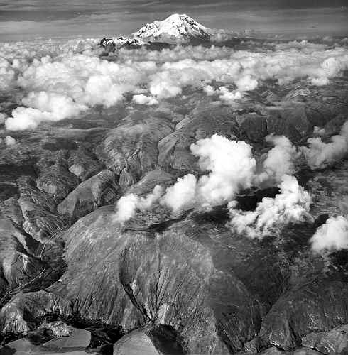
Photo by W. Mayo
727 heading for North Korea from Yokota AFB, later shot down by Migs.
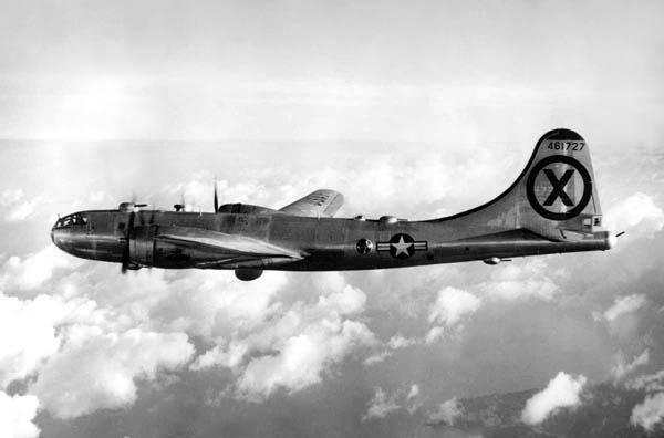
Photo by W. Mayo
Mt. Fuji, taken from 20,000 ft. returning from mission in Korea.
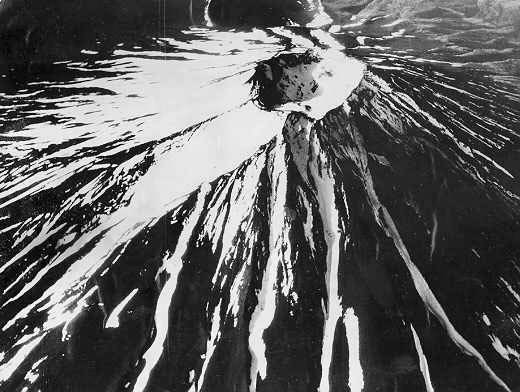
Photo by W. Mayo
Written by Wayland Mayo, website historian. Wayland is a Certified Photogrammetrist, and a Professional Surveyor and Mapper [retired] State of Florida.


